

by Laura-Lee Walker
Location intelligence involves using geographical data to make decisions. Geographic information is being used in a wide variety of sectors including transportation, retail, healthcare, government, and education.
Insurance companies can use it to better understand their risk exposure. Distributors can use location intelligence to improve stock levels and save money on shipments. Politicians can use this data to understand district demographics and determine where to direct their campaign efforts. Hospitals can determine where their patients are you located to effectively direct marketing to attract new patients.
Norse
Norse a powerful threat intelligence network that provides real-time visibility into global cyber attacks. A Norse map is shown above. It covers 47 countries and attack information for using over eight million sensors and accessing seven petabytes of attack histories. It also provides risk calculations for every IP address.
CrimeReports
Crime data associated with location, such as a street address, can provide input for analytics software to help police departments identify, forecast and prevent crimes.
For example, CrimeReports provides an online crime mapping solution that involves working with thousands of law enforcement agencies and the public to fight crime using tools such as a public crime map, anonymous tipping and data analytics.
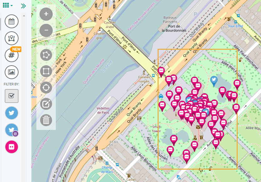
Echosec
Geo-fencing monitors social media across a geographical location and can be a useful tool for public safety, corporate security and the media. It’s especially useful when it involves investigations where there is a lot of social media chatter.
For example, it can help determine how to best provide security at a protest, protect dignitaries and business executives, and predict and prevent terrorist activities.
Echosec is one of many companies that provide location-base social media information. It works with a user selecting a geographical area. Real-time posts are then delivered for that region from a range of social media networks, such as Twitter, Instagram, and Flickr.
Geofeedia is another popular geo-fencing tool that works in a similar way as Echosec. It has made predictions about what we can expect to unfold for this year. It forecasts the trend towards global events having a local impact in communities of all sizes. It forecasts that location data will become increasingly available because of connected devices, wearables and drones. Location information is also predicted to become more essential in all areas of business.
Laura-Lee is an open-source intelligence analyst at Kusic and Kusic Private Investigators. She specializes in litigation support, background checks, and online investigations.
Photo sources: Norse, CrimeReports and Flickr.